
Geographic Information Systems


Satellite, Radar and Aerial Imagery For Sale:
Access to the best satellite images portfolios for Argentina, Uruguay, Chile and Perú. The interpretation and analysis of satellite images and aerial photography allows you to obtain quality information in a short period of time. Radar images show us the terrain and changes in it. This information is used for evaluation and monitoring of natural, economic and social phenomena. For example, in agriculture and livestock we use it to evaluate crop health, calculate areas with different yields, find the best harvest time, establish optimal animal carrying capacity, integrate zones with similar physical characteristics, define areas with water deficits, etc. In forested land it is used to calculate area of stands, find areas of greater erosion potential, evaluate health of species. On the public infrastructure sector, this information could be used to evaluate where to build certain infrastructure or determine the shortest path avoiding unwanted areas.
Eco Architecture:
The Eco-Architecture consists of designing buildings which take into account the climatic conditions. This type of architecture takes advantage of available resources such as the sun, vegetation and takes precautions against rain and prevailing winds, to reduce environmental impact and reduce energy consumption. An Eco-Architecture house can achieve great savings and even become fully sustainable without necessarily being more expensive.
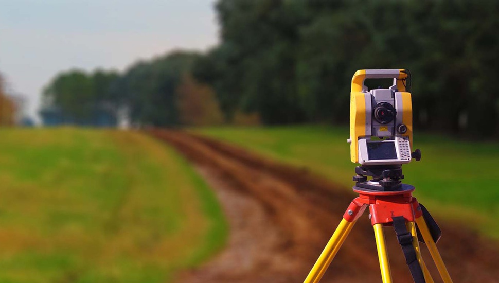
Land Surveying:
The information generated by surveyors can be incorporated into a Geographic Information Systems platform in order to cross-examine data and spatially analyze the territory. This combination is also ideal for very large, mountainous or hard-to-reach terrain where traditional surveying would take too long.
Terrain Modeling:
• Vegetation Analysis.
• Terrain Configuration
• Location of improvements.
• Water Drainages.
• Terrain Modeling
• Land Survey Reports and Databases.
• Volcanic ash Monitoring
• Emissions Monitoring
• Natural disasters Impacts (floods, earthquakes, etc.)
GIS Services for Architects, Engineers and Owners:
By analyzing the orientation of the projected building through aerial or satellite imagery, it is possible to make the most of the thermal energy of the sun when the weather is cold, as in Patagonia, or in high altitude environments, thus reducing the costs of energy needed for heating, hot water and lightning. This analysis can be combined with a study of the views you want to give preference or sectors that you want to hide.
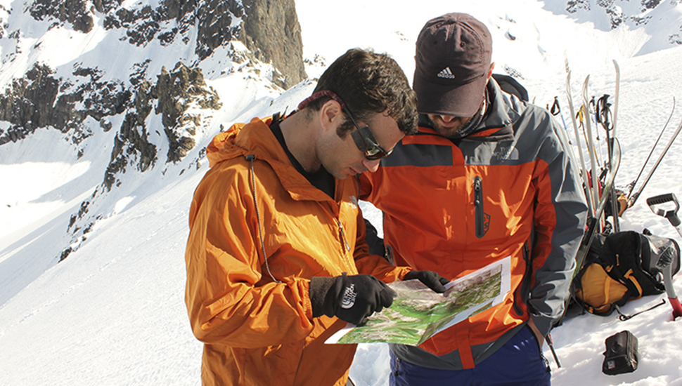
Avalanche Mapping:
Pixmap GIS Solutions provides avalanche risk assessment services for a wide spectrum of clients. Projects can vary in scope and complexity from the visit to a developing residential property, to the production of an avalanche atlas for a transportation corridor. Any organization planning to conduct work in mountain environments needs to have a solid knowledge of the risks involved. Once the risks have been identified, mitigation options can be considered. We work in partnership with Aprendica Outdoor Training, avalanche professionals from the American Institute for Avalanche Research and Education and the American Avalanche Association.- Avalanche Risk Assessments for building structures, works, winter centers, ski resorts, real estate developments- Avalanche Atlas development and hazard map- Avalanche flow modeling, runout extension or avalanche term and impact analysis with field measurements- Location of building structures in avalanche terrain, effects of creep and glide in transmission towers and walls- Risk analysis for transport corridors (avalanche hazard scale and other methods)- Security plans Development for avalanches.
Portfolio - Geographic Information Systems
・ Huella Andina, Ministerio de Turismo Argentino
・ Senderos de Argentina, Ministerio de Turismo Argentino
・ National Outdoor Leadership School (NOLS), Coyhaique, Aysén, Chile
・ Mitsubishi Research Institute, Tokyo Japón
・ INTA, Bariloche, Argentina
・ INFOR, Gobierno de Chile, Valdivia, Región de los Ríos, Chile
・ Municipalidad de San Carlos de Bariloche, Río Negro, Argentina
・ The Butler Foundation, NYC, USA
・ Escuela de Guías de la Patagonia, Coyhaique, Región de Aysén, Chile
・ Aprendica, Bariloche, Argentina
・ CIEP, Universidad Austral, Chile
・ Beha Ambiental, Bariloche, Río Negro, Argentina
・ The Nature Conservancy, Patagonia
・ Sendero de Chile
・ Beha Ambiental, Bariloche, Río Negro, Argentina
・ The Nature Conservancy, Patagonia
・ Sendero de Chile
・ Ganadera la Constancia S.A., Ea. Quechuquina, Provincia de Neuquén, Argentina
・ Gabriel Antolin, Agrimensor, Bariloche, Río Negro, Argentina
・ Tierras en Patagonia SA, Bariloche, Argentina
・ Establecimiento Ruculuán, Maquinchao, Río Negro